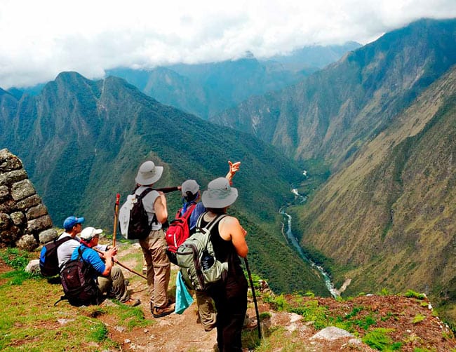
Part of the 23,000 kilometers (approximately 14,000 miles) of roads built by the Incas in South America, this is Peru’s most famous trekking route and possibly one of the most spectacular in the Americas. Every year; some 25,000 hikers from around the world walk along the extraordinary 43 kilometers of this stone-paved road built by the Incas leading to the unassailable citadel of Machu Picchu located in the depth of the Cuzco jungle.
Inca Trail information
Part of the 23,000 kilometers (approximately 14,000 miles) of roads built by the Incas in South America, this is Peru’s most famous trekking route and possibly one of the most spectacular in the Americas. Every year; some 25,000 hikers from around the world walk along the extraordinary 43 kilometers of this stone-paved road built by the Incas leading to the unassailable citadel of Machu Picchu located in the depth of the Cuzco jungle.
One of the trekkings options starts in the village of Qorihuayrachina, at kilometer 88 of the Cusco – Quillabamba railway and takes three or four days of strenuous walking. The route includes an impressive variety of altitudes, climates and ecosystems that range from the high Andean plain to the cloud forest.
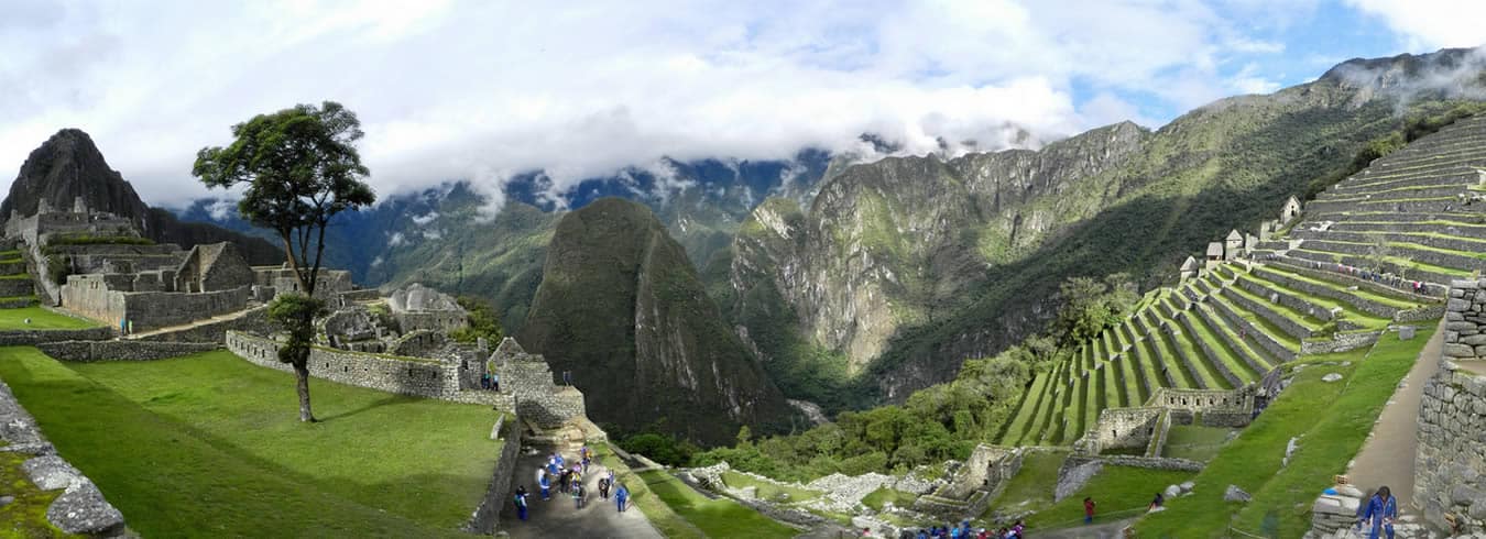
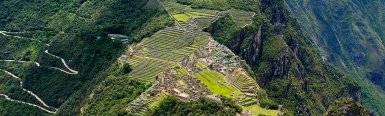
Travelers will cross two high altitude passes (the highest being Warmiwañuska at 4,200 m.a.s.l.) to culminate the hike with a magical entrance to Machu Picchu through the Inti Punku or Gateway of the Sun.
One of the main attractions along the route is the web of ancient settlements built in granite rock by the Incas like Wiñay Wayna and Phuyupatamarca immersed in an overpowering natural scenery. Hundreds of species of orchids, multicolored birds and dreamlike landscapes provide the ideal backstage for a route that every hiker should walk at least once.
Huayna Picchu:
Inca Trail Huayna Picchu mountain.- This is a new rule from the government; Inca Trail Huayna Picchu passes are only available for purchase with the general Machu Picchu entry ticket and there is a special entry ticket for the Inca Trail which does not allow this add-on. When you do the Inca Trail you are among the only people who enter Machu Picchu via the Sun Gate (rather than the general public entrance) and you receive a special Machu Picchu tour from there.
If you want to purchase a Huayna Picchu pass you will need to buy a new entry ticket for Machu Picchu as well (total USD $65 per person) – note that depending on the speed of your group you may actually have to sacrifice part of your Machu Picchu tour in order to climb Huayna Picchu in the second group. Ask us if you really want to climb Huayna Picchu – otherwise we do not recommend it for the Inca Trail.
The Inca Trail: Information
- The total distance of the trail is approximately 39.6 Km. and begins at Km. 88 at a place called Q’oriwayrachina. To begin the trail, you must cross the Kusichaca bridge, (an important Inca bridge which using Inca techniques, has been built with steel cables which allow visitors to cross the Urubamba River).
- Then you head over to the left bank through a Eucalyptus grove and start the day calmly.Almost immediately, you will come across the archaeological complexes of Q’ente, Pulpituyoc, Kusichaca and Patallaca.
- From this last spot, follow the trail along the left side of the Kusichaca River in the area with the same name where you will not only see the bridge but also you will find tombs, aqueducts, terraces. roads and a canyon.Continue until you reach the small peasant village of Wayllabamba and Inca aqueducts.
- It takes around four hours to cover the 9 Km up to this spot.One can camp here for the first night, but for comfort we recommend staying in Llullucha 1.6 Km further on. The second day in the inca trail is more difficult as the hiker will have to climb up to 4,200 meters, crossing the Warmiwañusqa pass, the first and the highest. If you suffer from “soroche” (altitude sickness) it is best not to stop and descend quickly to the valley of the Pakaymayu River, where you can camp.This spot is 7 Km away and an approximate eight-hour walk.
- The third day in the inca trail is the longest but most interesting. You will be able to visit impressive archaeological complexes such as Runkuraqay, the second pass, at 3,800 meters above sea level.
- This is a walled complex with interior niches that perhaps was a small place for rest, guard post and worship place. After crossing the second pass, descend to Yanacocha (the black lagoon), to then climb up a path with stone steps until you reach another cluster of buildings which attracts the attention of visitors.